One of the things that I come across when I do my tours in London and indeed everywhere else in the U.K. is some of the unusual names that can be found either of settlement names or street names. London has its fair share of weird names, some of them very traditional if a little obscene whilst others have been modernised or have had their original meanings forgotten and so the words have evolved to match up with modern words.
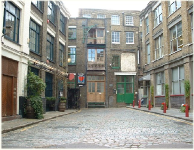
Bleeding Heart Yard
Legend has it that the body of Lady Elizabeth Hatton, brutally murdered in 1626, was found in Farringdon—her heart, torn from her body, was still beating nearby. Sceptics who frown on this urban legend claim the street was actually named after an old pub located there. You can visit Bleeding Heart Yard on my London Pub Crawl tour 🙂
Cockpit Steps
In Westminster, a walkway named Cockpit Steps, running south of Birdcage Walk, marks the former site of royal cockfights. For much of London’s history, cockfighting (and betting on cockfighting) was a popular pastime among the upper classes. The old Royal Cockpit was built in the 1700s. While this structure no longer exists, the steps remain, reminding travelers—for better or worse—of the old sport and we go right past it on my Walking Tour of London.
Fetter Lane
Fetter Lane (running north of Fleet Street) was apparently a place where medieval vagabonds congregated to feign diseases and other afflictions to evoke the pity of (and open the pocketbooks of) passersby. The name may be derived from the Middle English word faitour, which by medieval times had come to mean “false beggars.”
Flask Walk
This Hampstead lane was the location of several taverns that sold flasks of water—from a medicinal spring nearby—to London’s eating houses and others in the rapidly expanding 17th- and 18th-century city. No doubt due to the polluted waterways in the city.
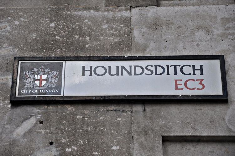
Houndsditch
Houndsditch, at the east end of London, was the medieval final resting place for the city’s deceased dogs and the rubbish disposed with them. Ironically, Jeremy Bentham—philosopher, legal and social reformer, and champion of animal rights—was born on the street in 1748. See my altogether fabulous post I wrote a few days ago on Mr Bentham here. You can also visit Houndsditch on my Jack The Ripper Daytime Walking Tour.
Mount Pleasant
Mount Pleasant was the tongue-in-cheek name for the medieval dumping ground of household refuse, ashes, and other trash, along the banks of the woefully polluted Fleet River in Clerkenwell (before the river was buried underground). The street name remains, though the irony is lost.
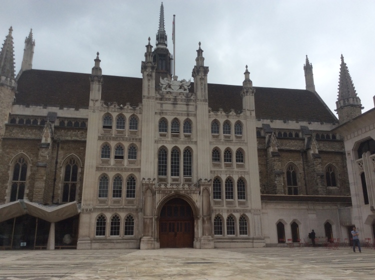
Old Jewry
Old Jewry, a one-way street near the present-day Guildhall, was once a Jewish settlement. Soon after the Norman Conquest, William the Conqueror encouraged Jews to come to England, and many ended up settling on or around Old Jewry in the city’s Jewish quarter. Come visit this hard to find part of old London on our Sacred Secret Sanctuary Gardens Walk
Pall Mall
Pall Mall’s name is derived from the popular game of the same name that was imported from France and Italy in the 16th and 17th centuries. The game, in which a mallet was used to hit a ball through a hoop hanging aboveground, was commonly played there. Today Pall Mall serves as the address of choice for London’s most celebrated and exclusive gentlemen’s clubs.
Pudding Lane
Belying its charming sounding name, “pudding” was actually the medieval term for animal guts, and Pudding Lane was a riverside street that housed many a butcher shop. Animal innards were tossed out the overhanging windows; gravity, time, and the occasional broom would funnel the “pudding” down the sharply pitched street to the flowing waste removal system known as the Thames. But Pudding Lane is most notorious as the site where the Great Fire of London started in 1666.
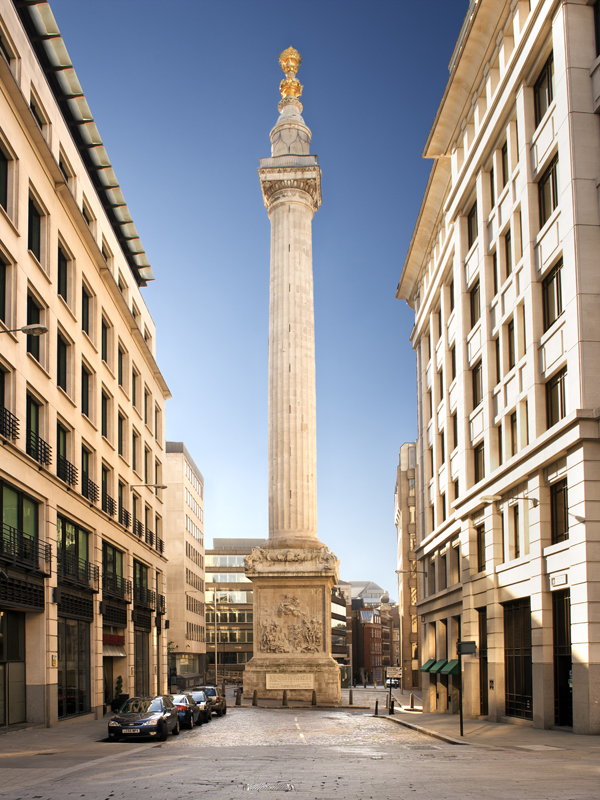
Pudding Lane is firmly on our Harry Potter Locations Walking Tour
Rotten Row
The story goes that Rotten Row, the mile-long (1.6 km) bridle path running along the southern edge of Hyde Park, derives its name from “Route du Roi,” French for the King’s Road, as this was the path William III built to travel to and from Kensington Palace. Debate prevails on the truth of this oft-repeated explanation… but let’s just go with it. Come and see it for yourself with our Royal London Tour.
Sherborne Lane
Running south of King William Street in the City, Sherborne Lane was formerly known as Shiteburne Lane – the street was a longtime public privy. London needed quite a few Sherborne Lanes; the human and animal inhabitants of medieval London produced 50 tons (45 tonnes) of excrement a day.

A very interesting post!
LikeLiked by 2 people
Thank-you!
LikeLike
When I was in college at Texas A&M University, I used to hang out at some live music bars near “Foch Street.” You can imagine how college students liked to pronounce that, especially after a few beers.
LikeLiked by 2 people
I can too lol
LikeLiked by 1 person
All intriguing names today, that back in the day meant something for the folks living in London!
LikeLiked by 1 person
Yes, how funny that Mount Pleasant is a sarcastic name from centuries ago.
LikeLiked by 1 person
Yeah, and who’d know now that pudding referred to offal!
LikeLiked by 1 person
It must have been an awful smeel when the Great Fire started there!!
LikeLiked by 1 person
ewe!
LikeLiked by 1 person
Interesting! Thankfully the UK leaders’ interest in overwriting historical, organic names with names of dubious leaders and do-gooders seems to be low.
LikeLiked by 1 person
Yes, so far we don’t have a Tony Blair Avenue or Margaret Thatcher Place. I remember when I go to Egypt, the whole country seems to be named after 2 or 3 dubious politicians and even musuem exhibit descriptions in English would mention “Our glorious leader”.
LikeLiked by 1 person
Interesting street ends.
LikeLiked by 1 person
1. It’s an old post and it’s probably bad blog etiquette to comment now.
2. It’s very childish, but
3. I do like Back Passage in the City. https://www.flickr.com/photos/ddtmmm/809554649/lightbox/
Hard to find on most maps and last time I was there the nameplate was missing, but it runs southeast from the southeast end of East Passage behind 69 – 72 Long Lane and another arm at 90 deg. to that runs between 69 & 70 connecting it to Long Lane.
Zoom in on the City rights of way map and click the appropriate blue area.
http://www.mapping.cityoflondon.gov.uk/geocortex/mapping/?viewer=compass&runworkflowbyid=Switch_layer_themes&LayerTheme=Show%20the%20City%20Rights%20of%20Way%20layers
LikeLike